In September 1775, Col. Benedict Arnold and his army of 1,143 men forged into Maine from Cambridge, Mass., on their 350-mile journey to Quebec City to fight the British during the Revolutionary War.
They traveled the Kennebec River through Winslow and Waterville in their heavy, flat-bottomed boats, called bateaux, which they hauled ashore to carry around waterfalls in the river, making repeated trips on foot to also retrieve barrels of food and ammunition.
They traveled north to Skowhegan, Madison and Anson and then to Caratunk and the west shore of Wyman Lake in Somerset County.
By the time they reached Quebec City on Nov. 14, they had endured horrendous hardships — bitter cold weather, snow and illness — with nearly half the men starving to death or dying from dysentery caused from consuming bad food and water. They had only about 20 of the 220 wooden, 22-foot-long bateaux they started with, as many were abandoned or lost.
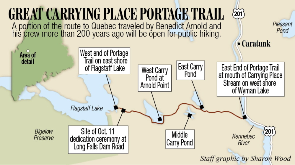
For the first time since Arnold’s expedition 239 years ago, the public will have a chance to hike a 13-mile strip of the trail Arnold’s expedition members followed from Wyman Lake to the shore of Flagstaff Lake.
On Saturday, members of the Arnold Expedition Historical Society will host a celebration at 11 a.m. at Flagstaff Lake to open the trail officially, for which they have raised money to buy and erect signs. A ceremony, a hike and a picnic are planned.
Society members have worked for seven years to obtain easements over properties so that people may hike the trail — and they finally have succeeded, according to society Secretary Steve Clark, of Scarborough.
Clark, formerly of Winslow, said people hiking the trail will see many of the sights Arnold and his soldiers saw along the way and that are described in Maine author Kenneth Roberts’ historical novel “Arundel,” based on journals Arnold and his soldiers kept during their trip.
“Reading a history book is one thing, but experiencing exactly the route the expedition traveled is another,” Clark, 78, said Thursday. “It will give people a good feeling for a part of their heritage. Those men doing this were very brave men. They were true patriots. The trail is not a battlefield per se, but they were heading to that battle. It was an epic journey.”
The 13-mile trail to be opened Saturday starts on the west shore of Wyman Lake at the mouth of Carrying Place Stream and continues due west into the three Carrying Ponds — East Carry Pond, Middle Carry Pond and West Carry Pond — according to Clark. The trail then continues to the shore of Flagstaff Lake, where the trail opening ceremony will be held.
Those attending the event should drive to the village of North New Portland on Route 16 and, at the sharp turn in the middle of the village, turn onto Long Falls Dam Road and travel exactly 21 miles, Clark said. At the junction of that road and Spring Road, they should park in a parking area where a large post designates the Great Carrying Place crossing.
Society members will erect the final sign to be posted at the site, and Clark and others will read aloud from Arnold’s journal, as well as from journals of other soldiers in his expedition, who describe that particular 13-mile stretch. Participants are asked to bring picnic lunches, and the group will hike an easy three-tenths of a mile to the shore of Flagstaff Lake and eat, Clark said. Those wanting to hike part or all of the 13 miles may do so.
Clark, who has hiked the 13 miles in five or six hours, described the trail as having beautiful views, including that of the Bigelow Mountain range. Hikers can almost sense the presence of Arnold and his men, he said.
“If you sit down in the woods and listen carefully along toward dusk, you can still hear them talking,” he said. “There are places to swim, a couple of springs. It’s a very interesting hike and it’s quite scenic.”
At the places where Arnold’s soldiers put the bateaux into the water at the various ponds, hikers instead will follow loops around those ponds and continue on foot where the soldiers took the bateaux out of the water and started walking, according to Clark.
Clark, a retired Waterville Senior High School vocational education teacher and coach, wrote a book in 2003 titled “Following Their Footsteps,” a combination guide and history that describes Arnold’s entire route, from Cambridge, Mass., to Flagstaff. Clark, who has been involved many years in the Appalachian Trail Club, also wrote “A Guide to Baxter State Park” and “Guide to the Appalachian Trail in Maine.”
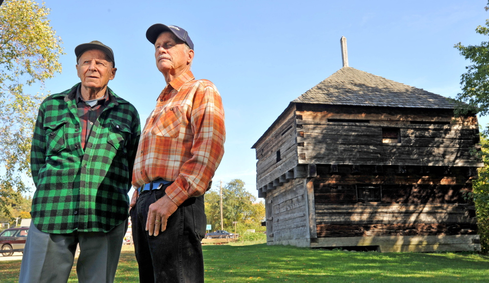
The Arnold Expedition Historical Society, incorporated in 1968 and based at the Major Reuben Colburn House in Pittston, has more than 100 members from all over the state and beyond, according to Winslow residents Henry Dillenbeck and Fred Clark, members of the society’s board of directors.
Dillenbeck and Clark — no relation to Steve Clark — said they also plan to attend the opening ceremony Saturday.
The Arnold Trail originally was developed by American Indians. The 13-mile stretch to be opened during the ceremony crosses property owned by the National Park Service, Plum Creek Co. Wagner Woodlands and individuals — all of whom granted easements so that hikers may enjoy the trail.
Last year, Fred Clark said, a young man put an old canoe into the river in Pittston and paddled up to Bingham, following the Arnold route to Quebec, including taking the Chaudiere and St. Lawrence rivers.
Society members visit the 13-mile stretch a couple of times a year with chain saws and other equipment to clear out trees that have blown down, according to Clark and Dillenbeck.
Amy Calder — 861-9247
Twitter: @AmyCalder17
Send questions/comments to the editors.


