Tom Desjardin is looking for an old ship. Actually, it’s a very old shipwreck, having sunk in 1635.
The Hallowell resident and director of the state’s Bureau of Parks and Lands learned about the Angel Gabriel through talking to University of Maine professor Warren Riess, who spent years trying to locate the ship in the 1970s.
The Angel Gabriel had set sail from England in May 1635, headed to New England with supplies and travelers making their way to the New World. Known to have wrecked off the coast of Bristol during a storm on that voyage, the ship has eluded searchers over the years. But with more sophisticated technology now available, Desjardin is hopeful the ship soon might be discovered on the ocean floor.
He said the Angel Gabriel reached Pemaquid — a village now known as Bristol — on Aug. 14. The village was bustling with industry, reliant on the fur trade and salt cod.
“It was becoming important because Europe was becoming more urbanized,” Desjardin said. “It was thriving as a small community.”

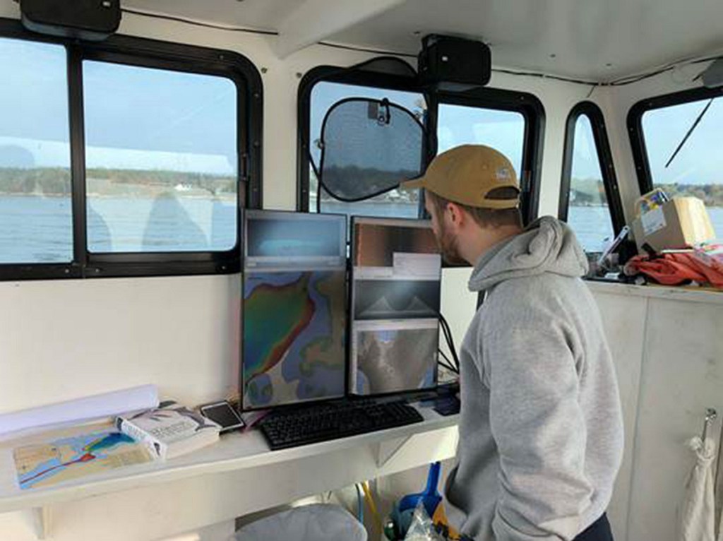
Bureau of Parks and Lands Director Tom Desjardin takes part earlier this year on the search for the 1635 wreck of the Angel Gabriel aboard the Amy Gale.
The ship, described as half cargo ship and half warship, anchored somewhere in the bay and most of its passengers disembarked. Pemaquid was a pit stop on the way to northern Massachusetts. But the Great Colonial Hurricane hindered the ship’s plan to go south.
According to the University of Rhode Island’s “Hurricanes: Science and Society,” the storm swept by the Jamestown Colony in Virginia without causing any damage. Prominent Massachusetts Bay Colony leader John Winthrop wrote that the storm blew with “such violence” and “abundance of rain.”
The surge from the storm was about 20 feet in Rhode Island. The storm toppled trees, destroyed homes and blew ships off their anchors. It was likened to a Category 3 hurricane, compared to modern storms that caused similar damage.
Riess, associate professor of history at UMaine, said the storm pulled the Angel Gabriel apart, destroying the 240-ton vessel and taking four lives with it.
“It burst into pieces while at anchor; the hull probably pulled apart,” he said. “It doesn’t happen a lot nowadays, but with the wooden ships it (did).”
The descendants of London merchant John Cogswell dedicated a plaque near the harbor in 1991, commemorating their family’s arrival, and it mentions the shipwreck. Another plaque was dedicated to the event in 2010, right outside of Pemaquid Harbor, where the Angel Gabriel met its fate.
Many of the ship’s passengers hopped onto the next boat to Massachusetts and eventually settled there.
Riess, 71, searched for the ship while living at home in Bristol as a graduate student in the late 1970s. His search involved number of boat outings, dives and different types of technology. He said his search turned up a few “anomalies” — noticeably disturbed areas on the sea floor — but nothing substantial was ever found.
“We had some anomalies in the magnetic field, and that’s about it,” he said. “We didn’t expect to find anything, and we didn’t, mostly just rock formations.”
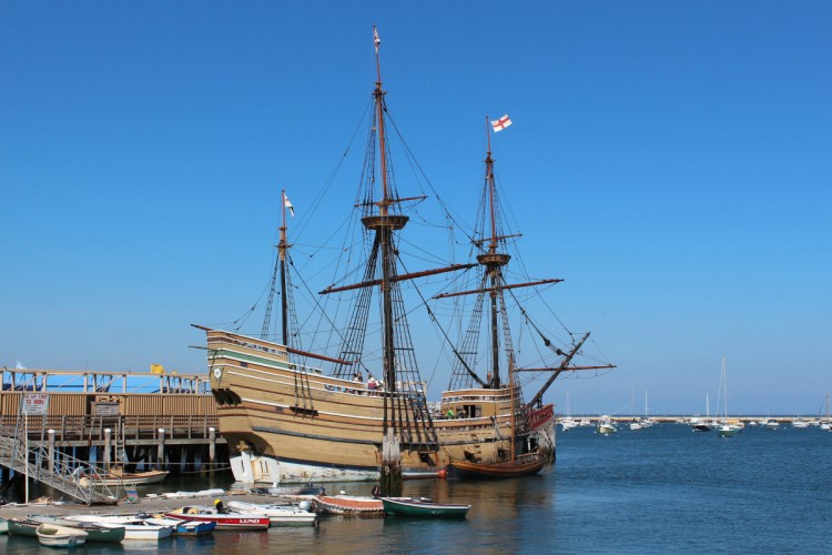
Riess said the ship was built for English explorer Sir Walter Raleigh’s last expedition to the New World in 1617. The ship then was purchased by merchants in Bristol, England, before it was drafted into a Spanish fleet, and then eventually bought by a trading post owner in Pemaquid. The Angel Gabriel is likened to the Mayflower in style, but it was 18 feet longer and had 18 cannons instead of the Mayflower’s 10.
Using a magnetometer, a device that measures magnetic force, Riess hunted to find any anomalies in the Pemaquid Harbor. The only area he did not search thoroughly was the mooring area for boats in the bay, because the presence of boats would have complicated the device’s readings.
“There are lots of chains and concrete blocks and expensive boats,” he said. “We didn’t want to drag electronics along there and get that all riled up.”
Riess stopped searching in the 1980s and published a book about his efforts, titled “Angel Gabriel: The Elusive English Galleon,” in 2001.
The search was put off until Desjardin picked it up this year after participating in an archaeological dig at the site.
For the past few months, he and a small crew have been mapping the bottom of the harbor, noting new anomalies along the sea floor.
“I always was interested in it, and it bothered me that it was just sitting there,” Desjardin said. “We’ve got to find this silly ship.”
He said the ship is a priceless artifact and people would be interested worldwide if it were discovered.
“It’s priceless in terms of the information we can glean from it,” Desjardin said. “It’s literally a time capsule.
“It doesn’t have stacks of gold bars, but the historical value is really great,” he added. “There’s probably 400-year-old bottles of wine down there.”
Riess said the discovery of the ship would confirm — or challenge — what historians know about ships built in the 1600s.
“The ship itself would be an important artifact because we don’t know much about the merchant ships from that time period,” he said. “We could learn a lot about the technology of the time.”
The bureau, which is funding the search, contracted help from the Department of Marine Resources’ Maine Coastal Mapping Initiative in the search. Desjardin said the initiative uses a ship with an “echosounder” to map the sea floor, and mapping this portion of the ocean fits with a goal to map the whole coastline’s floor.
Ben Kraun, a hydrographer at the department of marine resources, operates the echosounder system and oversees processing of the data. He said the initiative found an unmapped shipwreck near Pemaquid Point last year.

Rob Hallinan, left, Ben Kraun, front, and Caleb Hodgdon, back, prepare to drop a camera from the Amy Gale this year to survey anomalies aas part of the search for the 1635 wreck of the Angel Gabriel near Bristol.
This technology — which maps the physical features of the sea floor — is useful for finding anomalies. After they are found, Desjardin said, he drags a GoPro camera through the water in hope of getting a better look at the anomaly, but it’s an imperfect system that yields low-quality images of the area.
A submarine or an underwater drone would take clearer images, but the search has cost limitations.
Desjardin said he is hoping a major discovery will surface and whip up buzz, leading to other parties perhaps being willing to lend their time and resources to the expedition.
“There are a whole lot of others who would like to be part of it,” he said, “but you got to pull a cannon out of the water. Then lots of people would become very interested.”
Desjardin said the ship’s cannons should be easy to find, as a large group of iron guns would not decompose in the seawater and would show up clearly.
“Cannons don’t rot,” he said. “Some of them come out looking like they just came off the ship.”
He said his group has mapped John’s Bay and Pemaquid Harbor almost entirely, with only the mooring area uncharted. The next step for Desjardin and his crew is to check the newest anomalies and then map the mooring area that Riess was unable to map.
Riess was hopeful that improvements to technology would yield better results than his endeavor almost 40 years ago.
“A good mooring place then is probably a good mooring place now,” Riess said. “There’s a good chance that it was in those mooring areas.
“It (was) hard to ask a harbormaster if we could dig everything up,” he said.
Riess, citing his advancing age and workload as a professor, is not participating in the search now. He said he gave Desjardin his old research materials and has spoken to him about the ordeal.
“The interest is there, but the time isn’t,” he said. “If (Desjardin) finds the ship, I’ll buy the champagne.”
Sam Shepherd — 621-5666
Twitter: @SamShepME
Send questions/comments to the editors.


