

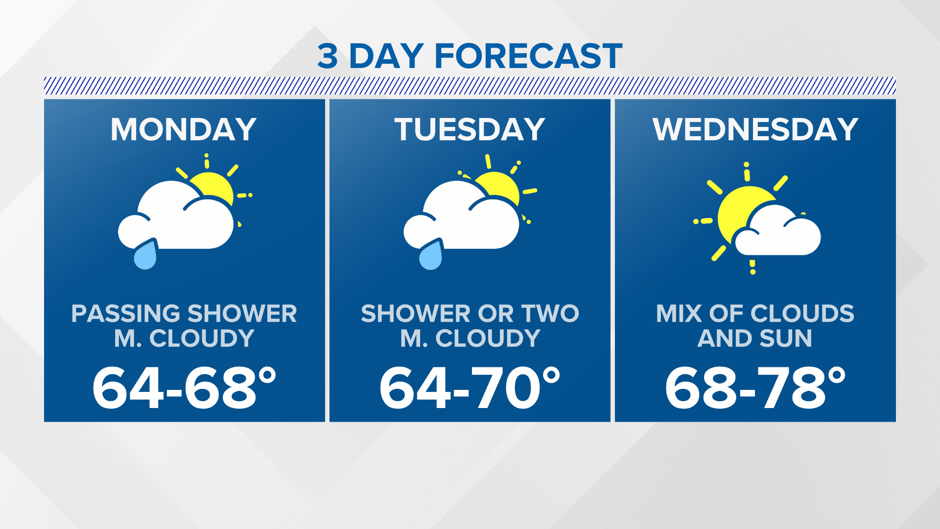
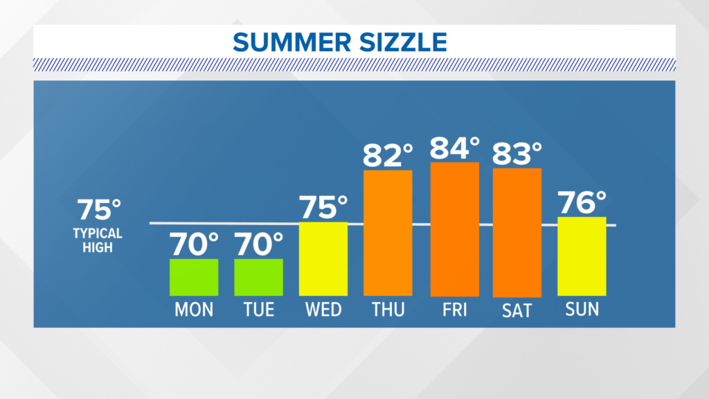
After what seems like weeks of gloom and doom and a cool Juneteenth, things are about to change drastically in the weather pattern. The temperature outlook takes us from barely 70 degrees to start this week to a run for 90 in a few days.
The change in the weather is courtesy of a big ridge of high pressure that moves in from the northwest by Thursday.
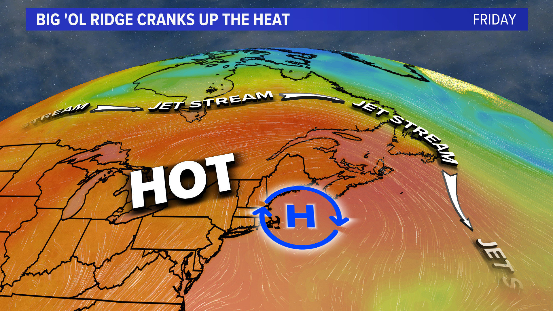
The “H” on the map will move to our south and east Friday and allow humidity to pump into Maine from a southwest breeze.
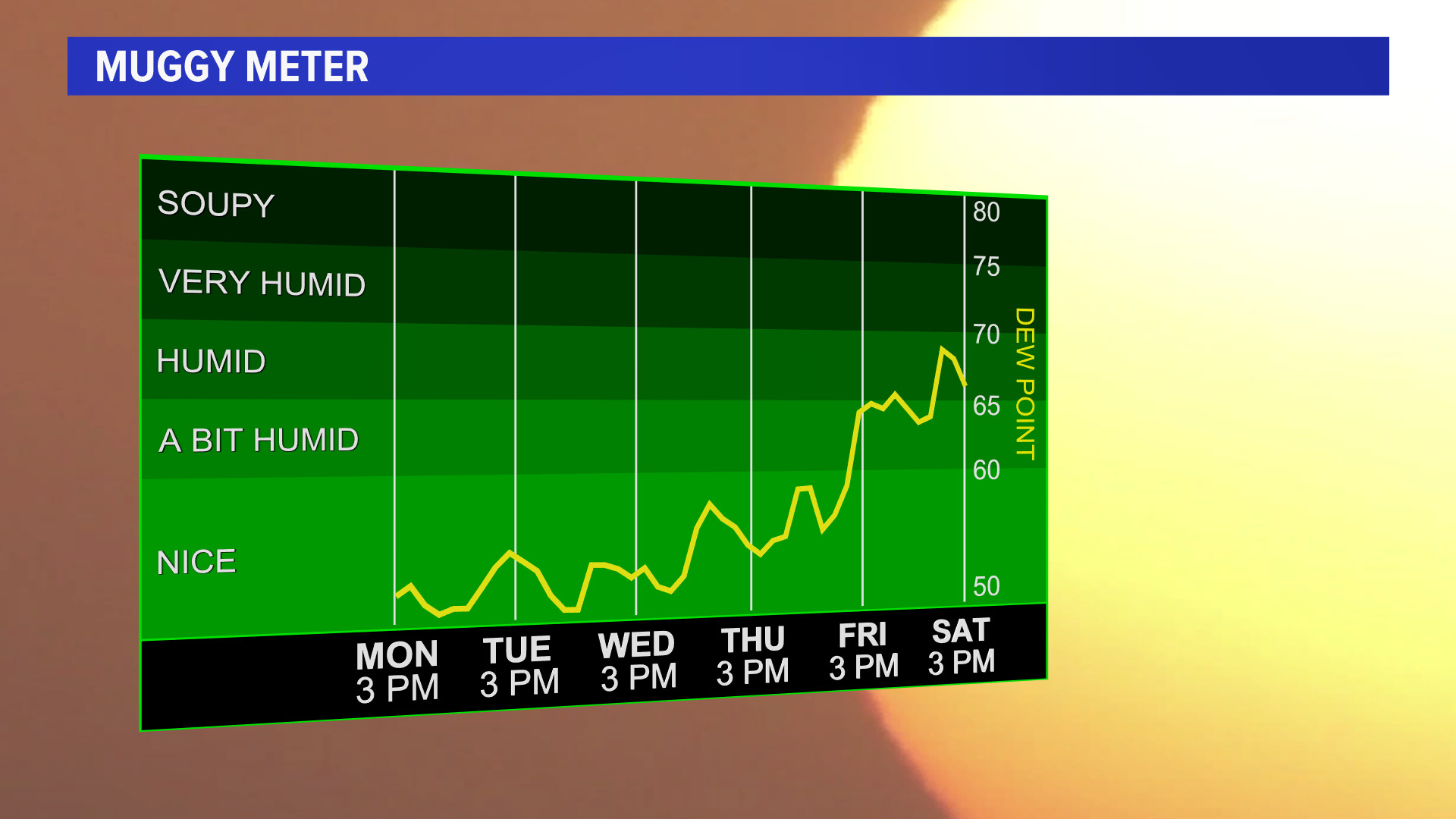
Dewpoints (the measure of moisture in the air) will skyrocket into the 60s and 70s by the end of the week.
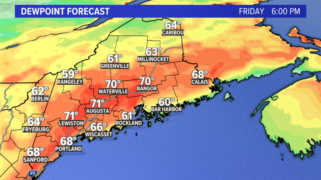
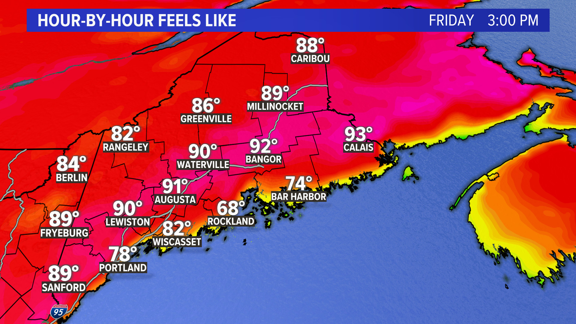
If you add the air temperatures that will at least be in the 80s …

… to the dewpoint temps in the 60s and 70s, we will see a heat index of around 90 degrees statewide (except for on the immediate coastline)
It’s time to get the A/C units in the windows (if you are lucky enough to have one).
The ridge is forecast to break down by the weekend, with rain expected to return then.
Send questions/comments to the editors.
